Trail Mountain bike Épagny Metz-Tessy - Mandallaz plateau - Photo
 rfonta
rfonta

User

© OpenStreetMap contributors
Length
Length
13.9 km
Max alt
Max alt
905 m
Uphill gradient
Uphill gradient
507 m
Km-Effort
Km-Effort  
21 km
Min alt
Min alt
519 m
Downhill gradient
Downhill gradient
508 m
Boucle
Boucle
Yes
Creation date :
2014-12-10 00:00:00.0
Updated on :
2014-12-10 00:00:00.0

(0 Reviews)

Mountain bike
Mountain bike
1h16
Difficulty : Medium

Scan this QR Code to open this trail in the SityTrail application

FREE GPS app for hiking

Logo SityTrail SityTrail

IGN / Geographical institutes

Download SityTrail from the App Store Download SityTrail from Google Play

Logo SityTrail SityTrail World

The world is yours!

Download SityTrail from the App Store Download SityTrail from Google Play Download SityTrail on Huawei AppGallery

About

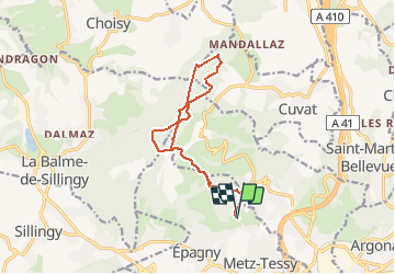
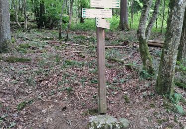
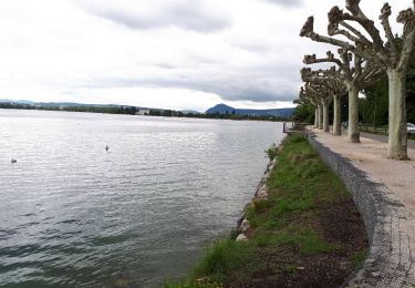
Trail Mountain bike of 13.9 km to be discovered at Auvergne-Rhône-Alpes, Upper Savoy, Épagny Metz-Tessy. This trail is proposed by rfonta.

Description

Départ parking "Champ Pontay" à Epagny. Passage derrière Auberge de Ferrieres puis direction Est par le haut. Retour par le bas.

Elevation profile

Photos

Points of interest

Point of interest Annecy - ferme ferrieres - Photo
rfonta

Positioning

Country:
France
Region :
Auvergne-Rhône-Alpes
Department/Province :
Upper Savoy
Municipality :
Épagny Metz-Tessy
Location:
Metz-Tessy
Start:(UTM)
275146 ; 5092593 (32T) N.

Trails nearby

Trail Mountain bike La Balme-de-Sillingy - MANDALLAZ super, pas pour débutant.  - Photo
Mountain bike
TFOLCHER

Mountain bike

Difficult
(1)
La Balme-de-Sillingy, Auvergne-Rhône-Alpes, Upper Savoy, France
17.2 km | 25 km-effort
2h 34min
No
Trail Cycle Annecy - semnoz par quintal - Photo
Cycle
jojoimothep

Cycle

Medium
(1)
Annecy, Auvergne-Rhône-Alpes, Upper Savoy, France
32 km | 52 km-effort
11min
No
Trail Walking Annecy - course avec tobias - Photo
Walking
Ckikiplus

Walking

Medium
Annecy, Auvergne-Rhône-Alpes, Upper Savoy, France
9.9 km | 13.7 km-effort
1h 40min
Yes
Trail Walking Épagny Metz-Tessy - La Golliettaz_29-08-2021 - Photo
Walking
GUIDE
Kargil

Walking

Medium
(1)
Épagny Metz-Tessy, Auvergne-Rhône-Alpes, Upper Savoy, France
15.5 km | 24 km-effort
3h 57min
Yes
Trail Walking Poisy - Marais de poisy, chemin de Poësy et vergers de Macully - Photo
Walking
COMAN

Walking

Very easy
Poisy, Auvergne-Rhône-Alpes, Upper Savoy, France
5.5 km | 7 km-effort
1h 25min
Yes
Trail Walking Épagny Metz-Tessy - petit tour de la mandallaz - Photo
Walking
COMAN

Walking

Easy
Épagny Metz-Tessy, Auvergne-Rhône-Alpes, Upper Savoy, France
8 km | 12.2 km-effort
3h 30min
Yes
Trail Walking Épagny Metz-Tessy - Boucle MANDALLAZ - Photo
Walking
Jean-Paulchoux

Walking

Easy
Épagny Metz-Tessy, Auvergne-Rhône-Alpes, Upper Savoy, France
8.5 km | 13.6 km-effort
2h 41min
Yes
Trail Other activity Annecy - le mont veyrier - Photo
Other activity
popo38

Other activity

Very easy
Annecy, Auvergne-Rhône-Alpes, Upper Savoy, France
18.2 km | 31 km-effort
5h 49min
Yes
Trail Other activity Annecy - Petit guide - Photo
Other activity
arperouse

Other activity

Very easy
(1)
Annecy, Auvergne-Rhône-Alpes, Upper Savoy, France
9.1 km | 14 km-effort
1h 40min
Yes


Close
My subscriptions